
 NATIONAL WATER QUALITY MONITORING COUNCIL
WQP Home >
Providers >
STORET >
DRMS


- Seep Below Champion Mill Tailings - DRMS-CMS-19 (Aggregate groundwater use)
- Sts. John Creek above the mill site - DRMS-EPA-SJ-2 (Stream)
- Adit discharge sampled at the mine portal - DRMS-EPA-SJA (Aggregate groundwater use)
- Unnamed tributary to Saints John Creek; sampled above the road - DRMS-EPA-SJA-2 (Stream)
- Halfmoon Creek Above Gate & Tributary, below Champion Mill - DRMS-HMC-01 (Stream)
- Halfmoon Creek at Gate Below Champion Mill & Unnamed Tributary - DRMS-HMC-02 (Stream)
- Halfmoon Creek above Confluence with North Halk Moon Creek - DRMS-HMC-03 (Stream)
- North Halfmoon Creek above Confluence with Half Moon Creek - DRMS-HMC-04 (Stream)
- Halfmoon Creek below Confluence with North Half Moon Creek - DRMS-HMC-05 (Stream)
- Halfmoon Creek above Confluence with South Halfmoon Creek - DRMS-HMC-06 (Stream)
- South Halfmoon Creek above Confluence with Halfmoon Creek - DRMS-HMC-07 (Stream)
- Halfmoon Creek below confluence with South Halfmoon Creek - DRMS-HMC-08 (Stream)
- Halfmoon Creek below Elbert - DRMS-HMC-11 (Stream)
- Halfmoon Creek at USGS Gage (#07083200 ) - DRMS-HMC-12 (Stream)
- Halfmoon Creek above confluence with Lake Fork - DRMS-HMC-13 (Stream)
- Unamed Tributary Below Prospect Adit; 200' above Conflunce with Halfmoon Creek - DRMS-HMC-14 (Stream)
- Halfmoon Creek below Fluvial Tailings from Champion Mill - DRMS-HMC-16 (Stream)
- Halfmoon Creek above Fluvial Tailings from Champion Mill - DRMS-HMC-17 (Stream)
- Halfmoon Creek above Champion Mill - DRMS-HMC-18 (Stream)
- Halfmoon Creek above Confluence with Unnamed Tributary - DRMS-HMC-20 (Stream)
- Unnamed Tributary above Confluence with Halfmoon Creek - DRMS-HMC-21 (Stream)
- Halfmoon Creek below Confluence with Unnamed Tributary - DRMS-HMC-22 (Stream)
- Illinois Gulch at Ice Arena. (TMDL) - DRMS-IG-01 (Stream)
- Illinois Gulch below Iron Springs Gulch Confluence. (TMDL) - DRMS-IG-02 (Stream)
- Illinois Gulch above Iron Springs Gulch Confluence. (TMDL) - DRMS-IG-03 (Stream)
- Iron Springs Gulch below Little Mountain Confluence. - DRMS-IG-04 (Stream)
- Iron Springs Gulch above Little Mountain Confluence. - DRMS-IG-05 (Stream)
- Little Mountain above Iron Springs Gulch Confluence. - DRMS-IG-06 (Stream)
- Little Mountain Spring 2 u Spring above mine influence. - DRMS-IG-07 (Stream)
- Little Mountain Spring 1 - Seep discharge. - DRMS-IG-08 (Stream)
- Iron Springs Gulch below Bright Hope Road. - DRMS-IG-09 (Stream)
- Iron Springs Gulch below Willard Adit Discharge and Mine Dump Seepage Confluence. - DRMS-IG-10 (Stream)
- Iron Springs Mine Dump Seepage above Confluence with Willard Adit Discharge. - DRMS-IG-11 (Aggregate groundwater use)
- Iron Springs Mine Dump Seep [a]. - DRMS-IG-12 (Aggregate groundwater use)
- Iron Springs Willard Adit Discharge: p-adt-1 - DRMS-IG-13 (Aggregate groundwater use)
- Illinois Gulch at Illinois Gulch Road. (TMDL) - DRMS-IG-14 (Stream)
- Illinois Gulch Head Waters. - DRMS-IG-15 (Stream)
- Puzzle Mine draining adit located 100 yards to the north of p-adt-1 - DRMS-IG-16 (Aggregate groundwater use)
- Illinois Gulch above Iron Springs Gulch Confluence; alternate location. - DRMS-IG-3-1 (Stream)
- Unnamed tributary, adjacent to tailings pond, above confluence with South Mosquito Creek - DRMS-L-3 (Stream)
- South Mosquito Creek midway through London Mine property - DRMS-L-5 (Stream)
- South Mosquito Creek below the Londom Mine property - DRMS-L-6 (Stream)
- South Mosquito Creek near seep (L-S1) - DRMS-L-7 (Stream)
- Landslide area near South Mosquito Creek - DRMS-L-7B (Stream)
- Seep upgradient of South Mosquito Creek - DRMS-L-S1 (Aggregate groundwater use)
- Mill Tailings Pond: South Discharge Pipe - DRMS-L-S4A (Aggregate groundwater use)
- Mill Tailings Pond: North Discharge Pipe - DRMS-L-S4B (Aggregate groundwater use)
- Leavenworth Creek Downstream of the Sydney Mine - DRMS-LV-05 (Stream)
- Leavenworth Creek below the Waldorf Mine - DRMS-LV-20 (Stream)
- Leavenworth Creek Tributary 2, near Road Crossing - DRMS-LVT-02 (Stream)
- Oh-Be-Joyful Creek above Redwell Creek - DRMS-OBJ-1 (Stream)
- Oh-Be-Joyful Creek below Redwell Creek - DRMS-OBJ-2 (Stream)
- Artesian Drill Hole - DRMS-RW-1 (Aggregate groundwater use)
- Redwell Creek above Daisy Mine - DRMS-RW-10 (Stream)
- Redwell Creek below Daisy Mine - DRMS-RW-11 (Stream)
- Redwell Creek below Additional Mining Impacts, at Outlet of Upper Basin - DRMS-RW-12 (Stream)
- Redwell Creek above Oh-Be-Joyful Creek - DRMS-RW-13 (Stream)
- Toe of Slope Below the Artesian Drill Hole, Apparent Spring - DRMS-RW-1a (Spring)
- Downstream of "Aluminum Pond" - DRMS-RW-2 (Stream)
- Upstream of "Aluminum Pond" - DRMS-RW-3 (Stream)
- Flow from Open Stope - DRMS-RW-4 (Aggregate groundwater use)
- The Red Well - DRMS-RW-5 (Stream)
- Redwell Creek above the Red Well - DRMS-RW-6 (Stream)
- Redwell Creek below the Red Well - DRMS-RW-7 (Stream)
- Daisy Mine Drainage - DRMS-RW-8 (Aggregate groundwater use)
- Spring below Daisy Mine - DRMS-RW-9 (Aggregate groundwater use)
- Springs above Elephant Trap - DRMS-S-11 (Stream)
- Drainage Below Reclaimed Tailings Area - DRMS-S-12 (Stream)
- Seep from Tailings Pile, West of Road - DRMS-S-5 (Aggregate groundwater use)
- Seep from Tailing Pile, Down-gradient of Tailings Pond, West of Road - DRMS-S-6 (Aggregate groundwater use)
- Seep above mill site - DRMS-SJ-5 (Stream)
- East tributary to Saints John Creek - DRMS-SJ-6 (Stream)
- Saints John Creek - DRMS-SJ-7 (Stream)
- Seep below tailings - DRMS-SJ-8 (Stream)
- In-stream below adit discharge - DRMS-SJA-3 (Stream)
- Waldorf Adit Discharge - DRMS-WMA-01 (Aggregate groundwater use)
- Waldorf Adit Discharge exiting Dump on North Side - DRMS-WMA-2 (Aggregate groundwater use)
- Waldorf Adit Discharge exiting Dump on South Side - DRMS-WMA-3 (Aggregate groundwater use)
- Waldorf Mine Seep from Waldorf Waste Pile - DRMS-WMS-1 (Aggregate groundwater use)
- Waldorf Mine Seep from Waldorf Waste Pile - DRMS-WMS-2 (Aggregate groundwater use)
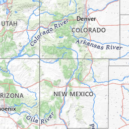
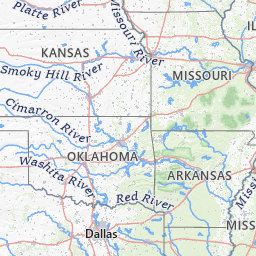
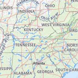
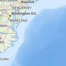
Water Quality Portal Data Sites for DRMS
Leaflet USGS The National Map: National Boundaries Dataset, 3DEP Elevation Program, Geographic Names Information System, National Hydrography Dataset, National Land Cover Database, National Structures Dataset, and National Transportation Dataset; USGS Global Ecosystems; U.S. Census Bureau TIGER/Line data; USFS Road data; Natural Earth Data; U.S. Department of State HIU; NOAA National Centers for Environmental Information. Data refreshed February, 2025.
This organization has 80 sites. Click on a grouped icon to zoom and expand
- Seep Below Champion Mill Tailings - DRMS-CMS-19 (Aggregate groundwater use)
- Sts. John Creek above the mill site - DRMS-EPA-SJ-2 (Stream)
- Adit discharge sampled at the mine portal - DRMS-EPA-SJA (Aggregate groundwater use)
- Unnamed tributary to Saints John Creek; sampled above the road - DRMS-EPA-SJA-2 (Stream)
- Halfmoon Creek Above Gate & Tributary, below Champion Mill - DRMS-HMC-01 (Stream)
- Halfmoon Creek at Gate Below Champion Mill & Unnamed Tributary - DRMS-HMC-02 (Stream)
- Halfmoon Creek above Confluence with North Halk Moon Creek - DRMS-HMC-03 (Stream)
- North Halfmoon Creek above Confluence with Half Moon Creek - DRMS-HMC-04 (Stream)
- Halfmoon Creek below Confluence with North Half Moon Creek - DRMS-HMC-05 (Stream)
- Halfmoon Creek above Confluence with South Halfmoon Creek - DRMS-HMC-06 (Stream)
- South Halfmoon Creek above Confluence with Halfmoon Creek - DRMS-HMC-07 (Stream)
- Halfmoon Creek below confluence with South Halfmoon Creek - DRMS-HMC-08 (Stream)
- Halfmoon Creek below Elbert - DRMS-HMC-11 (Stream)
- Halfmoon Creek at USGS Gage (#07083200 ) - DRMS-HMC-12 (Stream)
- Halfmoon Creek above confluence with Lake Fork - DRMS-HMC-13 (Stream)
- Unamed Tributary Below Prospect Adit; 200' above Conflunce with Halfmoon Creek - DRMS-HMC-14 (Stream)
- Halfmoon Creek below Fluvial Tailings from Champion Mill - DRMS-HMC-16 (Stream)
- Halfmoon Creek above Fluvial Tailings from Champion Mill - DRMS-HMC-17 (Stream)
- Halfmoon Creek above Champion Mill - DRMS-HMC-18 (Stream)
- Halfmoon Creek above Confluence with Unnamed Tributary - DRMS-HMC-20 (Stream)
- Unnamed Tributary above Confluence with Halfmoon Creek - DRMS-HMC-21 (Stream)
- Halfmoon Creek below Confluence with Unnamed Tributary - DRMS-HMC-22 (Stream)
- Illinois Gulch at Ice Arena. (TMDL) - DRMS-IG-01 (Stream)
- Illinois Gulch below Iron Springs Gulch Confluence. (TMDL) - DRMS-IG-02 (Stream)
- Illinois Gulch above Iron Springs Gulch Confluence. (TMDL) - DRMS-IG-03 (Stream)
- Iron Springs Gulch below Little Mountain Confluence. - DRMS-IG-04 (Stream)
- Iron Springs Gulch above Little Mountain Confluence. - DRMS-IG-05 (Stream)
- Little Mountain above Iron Springs Gulch Confluence. - DRMS-IG-06 (Stream)
- Little Mountain Spring 2 u Spring above mine influence. - DRMS-IG-07 (Stream)
- Little Mountain Spring 1 - Seep discharge. - DRMS-IG-08 (Stream)
- Iron Springs Gulch below Bright Hope Road. - DRMS-IG-09 (Stream)
- Iron Springs Gulch below Willard Adit Discharge and Mine Dump Seepage Confluence. - DRMS-IG-10 (Stream)
- Iron Springs Mine Dump Seepage above Confluence with Willard Adit Discharge. - DRMS-IG-11 (Aggregate groundwater use)
- Iron Springs Mine Dump Seep [a]. - DRMS-IG-12 (Aggregate groundwater use)
- Iron Springs Willard Adit Discharge: p-adt-1 - DRMS-IG-13 (Aggregate groundwater use)
- Illinois Gulch at Illinois Gulch Road. (TMDL) - DRMS-IG-14 (Stream)
- Illinois Gulch Head Waters. - DRMS-IG-15 (Stream)
- Puzzle Mine draining adit located 100 yards to the north of p-adt-1 - DRMS-IG-16 (Aggregate groundwater use)
- Illinois Gulch above Iron Springs Gulch Confluence; alternate location. - DRMS-IG-3-1 (Stream)
- Unnamed tributary, adjacent to tailings pond, above confluence with South Mosquito Creek - DRMS-L-3 (Stream)
- South Mosquito Creek midway through London Mine property - DRMS-L-5 (Stream)
- South Mosquito Creek below the Londom Mine property - DRMS-L-6 (Stream)
- South Mosquito Creek near seep (L-S1) - DRMS-L-7 (Stream)
- Landslide area near South Mosquito Creek - DRMS-L-7B (Stream)
- Seep upgradient of South Mosquito Creek - DRMS-L-S1 (Aggregate groundwater use)
- Mill Tailings Pond: South Discharge Pipe - DRMS-L-S4A (Aggregate groundwater use)
- Mill Tailings Pond: North Discharge Pipe - DRMS-L-S4B (Aggregate groundwater use)
- Leavenworth Creek Downstream of the Sydney Mine - DRMS-LV-05 (Stream)
- Leavenworth Creek below the Waldorf Mine - DRMS-LV-20 (Stream)
- Leavenworth Creek Tributary 2, near Road Crossing - DRMS-LVT-02 (Stream)
- Oh-Be-Joyful Creek above Redwell Creek - DRMS-OBJ-1 (Stream)
- Oh-Be-Joyful Creek below Redwell Creek - DRMS-OBJ-2 (Stream)
- Artesian Drill Hole - DRMS-RW-1 (Aggregate groundwater use)
- Redwell Creek above Daisy Mine - DRMS-RW-10 (Stream)
- Redwell Creek below Daisy Mine - DRMS-RW-11 (Stream)
- Redwell Creek below Additional Mining Impacts, at Outlet of Upper Basin - DRMS-RW-12 (Stream)
- Redwell Creek above Oh-Be-Joyful Creek - DRMS-RW-13 (Stream)
- Toe of Slope Below the Artesian Drill Hole, Apparent Spring - DRMS-RW-1a (Spring)
- Downstream of "Aluminum Pond" - DRMS-RW-2 (Stream)
- Upstream of "Aluminum Pond" - DRMS-RW-3 (Stream)
- Flow from Open Stope - DRMS-RW-4 (Aggregate groundwater use)
- The Red Well - DRMS-RW-5 (Stream)
- Redwell Creek above the Red Well - DRMS-RW-6 (Stream)
- Redwell Creek below the Red Well - DRMS-RW-7 (Stream)
- Daisy Mine Drainage - DRMS-RW-8 (Aggregate groundwater use)
- Spring below Daisy Mine - DRMS-RW-9 (Aggregate groundwater use)
- Springs above Elephant Trap - DRMS-S-11 (Stream)
- Drainage Below Reclaimed Tailings Area - DRMS-S-12 (Stream)
- Seep from Tailings Pile, West of Road - DRMS-S-5 (Aggregate groundwater use)
- Seep from Tailing Pile, Down-gradient of Tailings Pond, West of Road - DRMS-S-6 (Aggregate groundwater use)
- Seep above mill site - DRMS-SJ-5 (Stream)
- East tributary to Saints John Creek - DRMS-SJ-6 (Stream)
- Saints John Creek - DRMS-SJ-7 (Stream)
- Seep below tailings - DRMS-SJ-8 (Stream)
- In-stream below adit discharge - DRMS-SJA-3 (Stream)
- Waldorf Adit Discharge - DRMS-WMA-01 (Aggregate groundwater use)
- Waldorf Adit Discharge exiting Dump on North Side - DRMS-WMA-2 (Aggregate groundwater use)
- Waldorf Adit Discharge exiting Dump on South Side - DRMS-WMA-3 (Aggregate groundwater use)
- Waldorf Mine Seep from Waldorf Waste Pile - DRMS-WMS-1 (Aggregate groundwater use)
- Waldorf Mine Seep from Waldorf Waste Pile - DRMS-WMS-2 (Aggregate groundwater use)